Maps of the World Home > World Map Collection > Manila And Suburbs 1898, Historical Map
Printable Map of Manila And Suburbs 1898, Historical
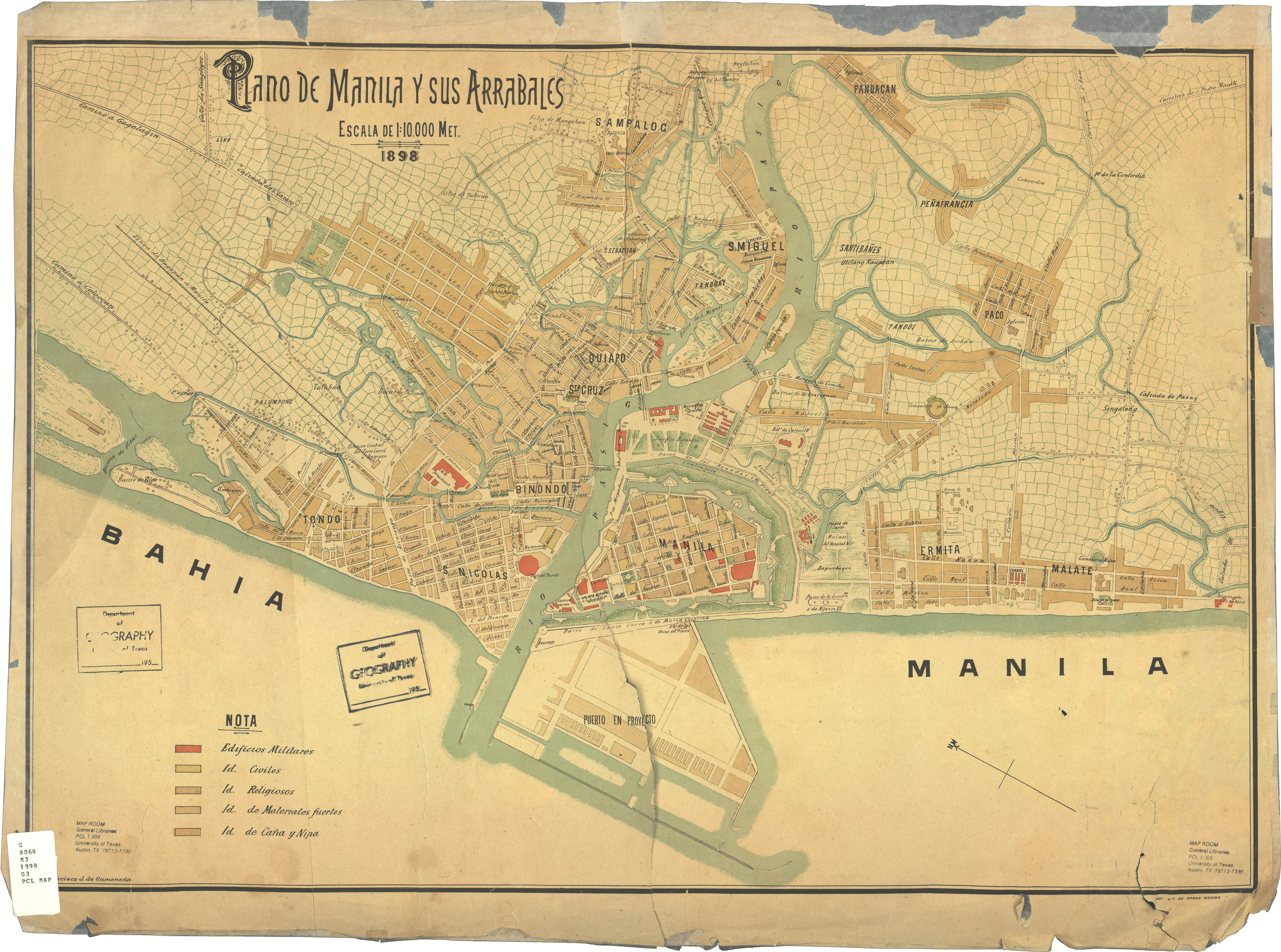
The above map image is a plain graphic that shows the layout of this locality with a classic mixture of features.
You have permission to print the map file and use it for many purposes. Linking back to this resource is always appreciated. Thank you.
Supposing you desire assistance retrieving a map, a specific map, or desire a high quality custom-made map, you can contact us.
Order good custom maps from us. A custom map made by us cover a huge array of details, such as: parkways, legend, GPS coordinates, bays, indian reserves, springs, hamlets, or rapids, etc. Map types range from economic geography to satellite, static to dynamic, national to traffic analysis zones.
High Quality maps are accurate, current, and not obsolete. Detail-Oriented map design by YellowMaps.
To procure paper maps, for instance wall maps, folded maps, or hiking maps, simply visit our online map shop It contains over 100,000 products.
Have trouble printing or downloading this map? Just contact us.
Back to World map collection