Maps of the World Home > World Map Collection > Philippines General Reference Map
Printable Map of Philippines General Reference
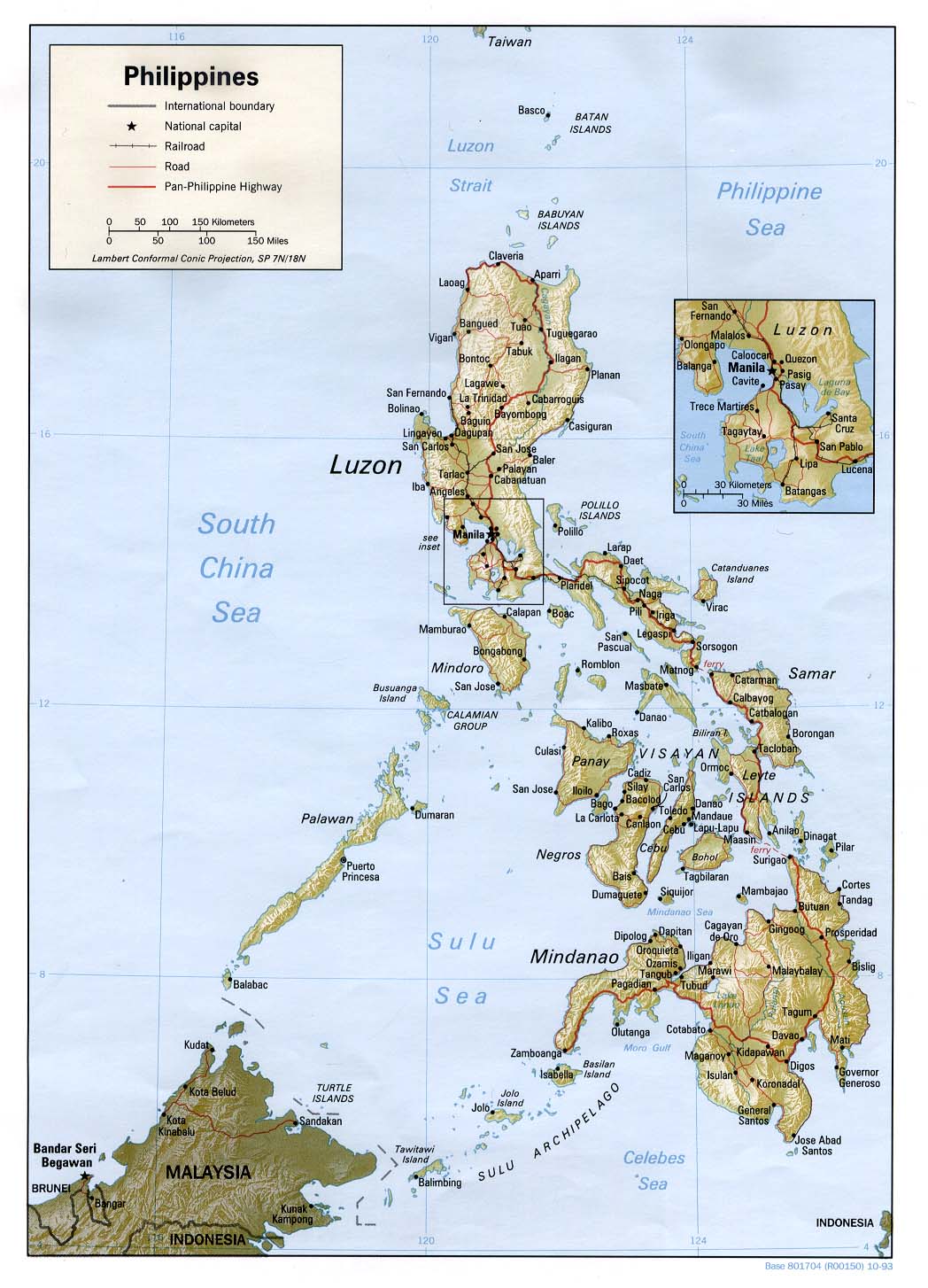
The above is a classic map that displays the political boundaries of this area of interest with a classic assortment of details.
You can download this web page and work with it for many purposes. Linking back to this resource would be our request.
Supposing you are hoping for support retrieving a map, a distinct kind of map, or are hoping for a good tailor-made product, simply email us.
Buy first-rate customized maps from us. Our custom maps cover a wholesome combination of elements, e.g.: streets, scale bar, coordinates, capes, major municipal/district areas, territories, falls, or natural resources sites, etc. Types of maps run from general reference to satellite, large-print to small-print, regions to urban growth areas.
Good maps are explicit, all-inclusive, and not deceptive. Skillful map-making by YellowMaps.
To procure printed maps or charts, such as recreation atlases, maps for kids, or maps for exploring, please marvel at the cartographic delights in our online map shop We carry over 100,000 items.
Fun fact about maps: the word 'map' comes from the Latin 'mappa mundi', meaning 'world on cloth'.
Back to World map collection