Maps of the World Home > World Map Collection > Lianga Bay Map - IMW
International Map of The World: Lianga Bay: IMW-nc-52
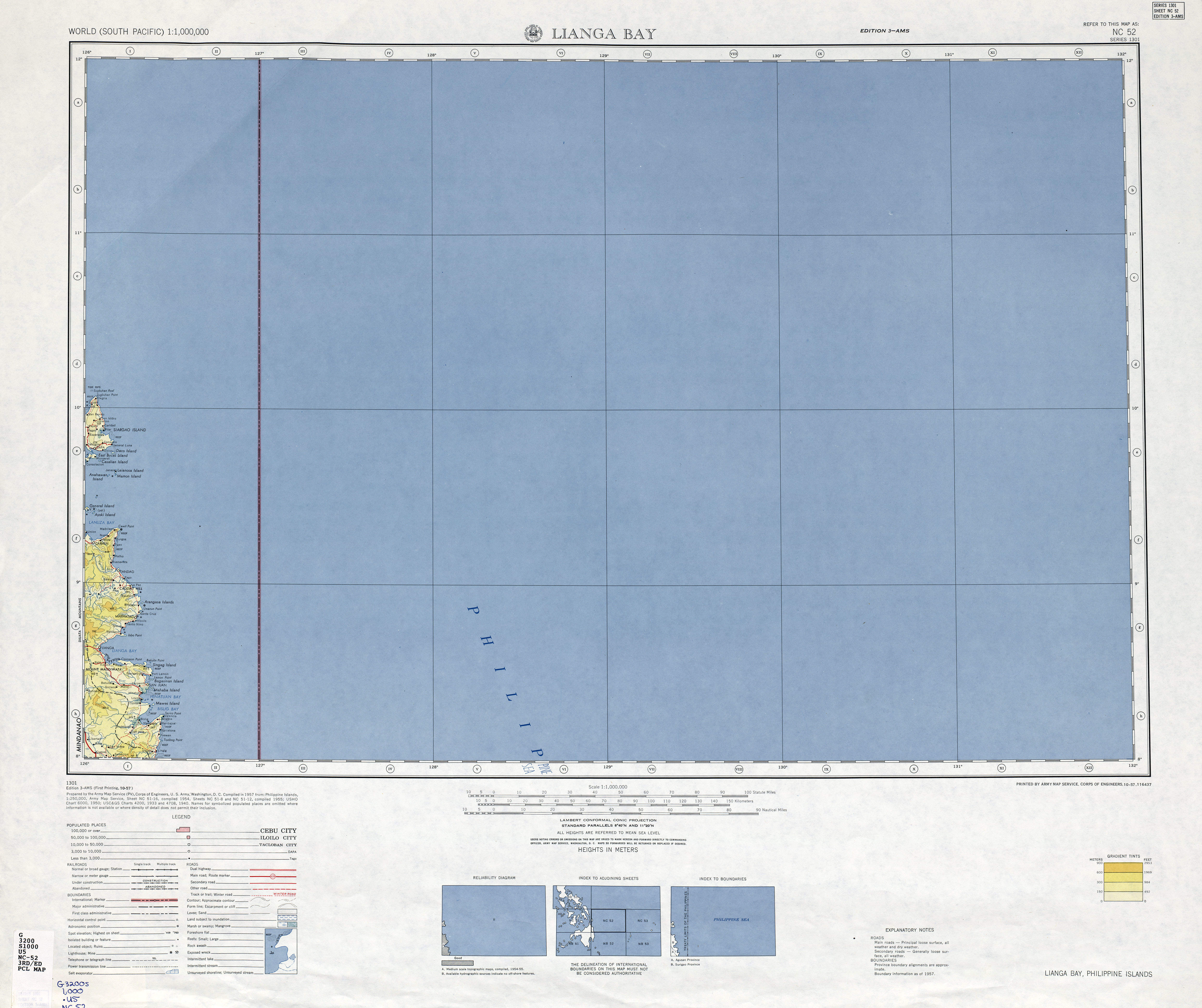
On top we have a classic figure presenting the spatial layout of this locale with a simple collection of map elements.
You may print this web page and make use of it for many purposes. Citing this page is always appreciated. Thank you.
In the event you call for support retrieving a map, a special kind of map, or call for a tip-top custom-made product, quickly email us.
Acquire high quality custom maps from us. A custom map made by us provide a wholesome mixture of features, for example: expressways, legend, coordinates, bays, marine navigation features, shoals, forests, or road features, etc. Map types range from political to city, navigation to general reference, state or province to metropolitan statistical areas.
Tip-Top maps are clear, all-inclusive, and not obsolete. Skillful map-making by YellowMaps.
To acquire hardcopy maps, such as recreation atlases, state maps, or hiking maps, simply marvel at the cartographic delights in YellowMaps Map Store We hold over 100,000 map items.
Fun fact about maps: the word 'map' comes from the Latin 'mappa mundi', meaning 'world on cloth'.
Back to World map collection